
0.67 Ha (1.66 Ac) Arable Land/Woodland, School Road , Horning , Norwich , Norfolk, NR12
- PROPERTY TYPE
Farm Land
- SIZE
72,118 sq ft
6,700 sq m
Description
The land is offered for sale as a whole as shown outlined red on the sale plan. The land parcel adjoins School Road and benefits from a gated access which leads on to a hardcore track.
Boundaries are formed by a mature roadside hedge, brick wall, domestic hedges and fencing and an open ditch along the southern boundary.
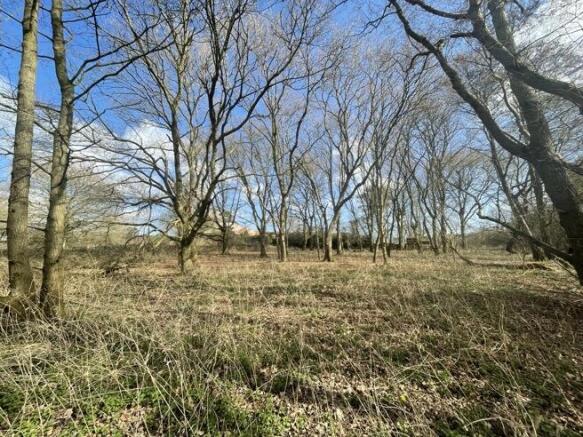
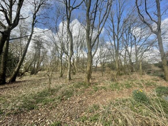
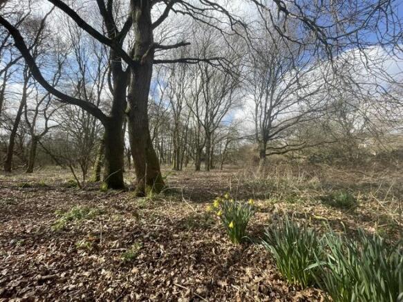
The land parcel has regenerated over the years and now supports a number of well established oak and alder trees with a mixed understorey.
LOCATION
The land is located on the south eastern fringe of the village of Horning. Horning adjoins the River Bure and omprises a range of local amenities, shops, pubs and a primary school and is a popular destination with tourists. The village of Potter Heigham is 6.0 miles to the north east and the villages of Hoveton & Wroxham are approximately 3.5 miles to the north west. The City of Norwich is approximately 13 miles to the south west.
DIRECTIONS
Drive through the village of Wroxham on the A1151 and continue over at the first mini roundabout and turn right at the second mini roundabout onto the A1062, Horning Road, signposted for Potter Heigham / Ludham / Horning. Follow this road for approximately 3 miles and on passing the sign for Upper Street (Horning) take the next right turn signposted School / Church. Follow this road for 200 yards and turn right onto School Road. Continue along School Road for approximately 0.5 miles and the land will be found on your left. The access has a galvanised gate as marked by the "For Sale" board. There is the ability to park off the road, directly in front of the gate.
Nearest postcode: NR12 8PX
what3words: ///cucumber.bleat.detective
GENERAL REMARKS AND STIPULATIONS
VIEWING
Viewing during daylight hours only with a copy of these particulars in hand. Please be careful and vigilant when making an inspection for your own personal safety. We advise wearing boots when making your inspection. Neither the Agents or the Vendors accept any liability.
METHOD OF SALE
The property is offered for sale by Private Treaty as a whole with a Guide Price of £40,000.
TENURE AND POSSESSION
Freehold. Vacant possession will be given on completion.
MINERALS, TIMBER AND SPORTING RIGHTS
In so far as they are owned by the vendor, the timber and sporting rights are included in the sale. The mines / mineral rights are reserved to the Church Commissioners.
LAND REGISTRY
The land is registered with the Land Registry and forms part of Title NK212120.
PLANNING
The property is within the jurisdiction of North Norfolk District Council, to whom interested parties are advised to make their own enquiries in respect of any planning issues and development opportunities for the property.
RIGHTS OF WAY, EASEMENTS, WAYLEAVES AND COVENANTS
The property is sold subject to, and with the benefit of all easements, rights of way, privileges etc., which may affect the same, whether mentioned hereto or not. In particular, Anglian Water have a Right of Way over the track to gain access to their pumping station.
OUTGOINGS
None.
AUTHORITIES
North Norfolk District Council -
Norfolk County Council -
Environment Agency -
VAT
No VAT will be charged on the sale of the land.
PARTICULARS AND PLANS
These particulars and plans are based upon the Ordnance Survey metric editions and are believed to be correct, but their accuracy cannot be guaranteed.
MONEY LAUNDERING REGULATIONS
We confirm that under Money Laundering Regulations we are required to check the identity of the purchaser(s).
DISPUTES
Should any dispute arise between the Vendor and the purchaser(s) as to the boundaries, fences or any other point arising out of these particulars, then the Agent's decision shall be binding upon all parties.
Brochures
Brochure0.67 Ha (1.66 Ac) Arable Land/Woodland, School Road , Horning , Norwich , Norfolk, NR12

NEAREST STATIONS
Distances are straight line measurements from the centre of the postcode- Hoveton & Wroxham Station3.0 miles
- Salhouse Station3.8 miles
- Acle Station5.2 miles

Notes
Disclaimer - Property reference 336515FH. The information displayed about this property comprises a property advertisement. Rightmove.co.uk makes no warranty as to the accuracy or completeness of the advertisement or any linked or associated information, and Rightmove has no control over the content. This property advertisement does not constitute property particulars. The information is provided and maintained by Arnolds Keys - Irelands Agricultural, Norwich. Please contact the selling agent or developer directly to obtain any information which may be available under the terms of The Energy Performance of Buildings (Certificates and Inspections) (England and Wales) Regulations 2007 or the Home Report if in relation to a residential property in Scotland.
Map data ©OpenStreetMap contributors.