
East Kilbride, Glasgow, South Lanarkshire, G75

- PROPERTY TYPE
Land
- SIZE
3,768,376 sq ft
350,094 sq m
Key features
- About 86 acres (35 hectares)
- For sale as a whole
- Ranging from 237 metres to 247 metres above sea level
- Class 3(2) and 5(3) James Hutton Institute and classification
- Connection to 3 phase electricity supply
Description
Description
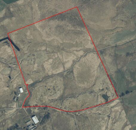
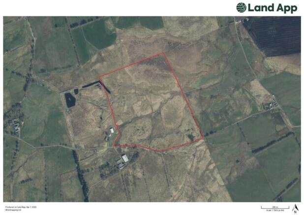
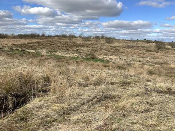
The subjects comprise a single block of farmland extending to approximately 86 acres (35 hectares) in total and ranging from 237 metres to 247 metres above sea level. The land has been owned by our client since 2017 and prior to that was farmed as part of Meadowhead Farm. It is classified by the James Hutton Institute land classification maps as Class 3(2) and 5(3), however having not been farmed for some time has fallen fallow.
A prior notification was submitted to South Lanarkshire Council in March 2024 (Ref: P/24/0273) confirming no prior approval required in connection with the erection of an agricultural building at the property. Further details are available from the selling agents.
Recent works on the land include creation of a new road and levelling of the site closest to the road. There is also a connection to the 3 phase electricity supply in the south east corner of the land. Access to the land is directly off the High Cleughearn Road. There is no mains water supply on the site.
The boundaries of the property are as shown on the plan included within these particulars.
Location
The land at Meadowhead is located between the towns of East Kilbride and Strathaven, adjacent to High Cleughearn Fishery and otherwise surrounded by farmland.
Acreage: 86.51 Acres
Directions
From Strathhaven, head north on the A726 (Glasgow Road). After 2.6 miles (approx.) turn left on to High Cleughearn Road, just before the left hand bend. Follow this road for a further 2.8 miles (approx.) and the land is on the right hand side. You will see Meadowhead Farm on the left hand side of the road. what3words: ///player.electric.twinkling
Brochures
Web DetailsEast Kilbride, Glasgow, South Lanarkshire, G75

NEAREST STATIONS
Distances are straight line measurements from the centre of the postcode- East Kilbride Station3.2 miles
- Hairmyres Station3.7 miles
- Thorntonhall Station4.8 miles

About Savills Rural Sales, Dumfries
Monreith House, The Crichton Glencaple Road Dumfries Dumfries and Galloway, DG1 4ZZNotes
Disclaimer - Property reference DFR250009. The information displayed about this property comprises a property advertisement. Rightmove.co.uk makes no warranty as to the accuracy or completeness of the advertisement or any linked or associated information, and Rightmove has no control over the content. This property advertisement does not constitute property particulars. The information is provided and maintained by Savills Rural Sales, Dumfries. Please contact the selling agent or developer directly to obtain any information which may be available under the terms of The Energy Performance of Buildings (Certificates and Inspections) (England and Wales) Regulations 2007 or the Home Report if in relation to a residential property in Scotland.
Map data ©OpenStreetMap contributors.