Staverton
- PROPERTY TYPE
Land
- SIZE
Ask agent
Key features
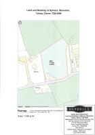
- 1.616 acres (0.654 hectares)
- Pasture Land
- Agricultural Building with lean-to
- Good Access
- Secluded Location
- Best and Final Offers Invited by 12 noon on Tuesday 22nd April 2025
Description
Situation
The property is conveniently situated between the popular villages of Staverton and Landscove and benefitting from a rural and secluded location, but being within a short distance of the amenities and services of both Dartington and the market town of Totnes, which lie just to the south. The property is approximately 2 ½ miles north of Dartington and approximately 4 ½ miles north of Totnes and approximately 4 ½ miles east of Buckfastleigh and the A38 Devon Expressway.
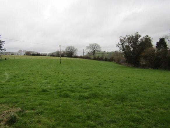
The Land
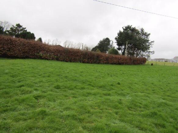
The land extends in total to 1.616 acres (0.654 hectares) of free draining gently south and east facing. The land is stock fenced with sheep netting to the north, east and south boundaries and there is a thick beech hedge on the western boundary.
Access to the land is directly off the adjoining road via a track and a 12'0 gated entrance.
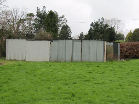
The Building
To the west of the land is an agricultural building extending to 50'0 x 20'0 with a further 38'0 x 16'0 lean to which is metal and timber framed under a Galvaprime roof with Galvaprime cladding to the sides and a stoned floor.
Services
The is not connected to any services but it is understood that an electricity and water connection is nearby.
Basic Payment Scheme & Other Stewardship Schemes
The land is not registered for the Rural Payments Agency's Basic Payment Scheme or is currently in any Stewardship Scheme.
Wayleaves, Rights & Easements
The property is sold subject to any Rights of Way, Wayleaves, Rights or Easements which exist at the time of sale whether they are mentioned in these particulars or not.
Tenure
Freehold with vacant possession upon completion.
Local Authority
South Hams District Council. Follaton House, Plymouth Road, Totnes TQ9 5NE. Tel:
Viewing
Viewing is by appointment only, therefore please contact Rendells Totnes Office on or email: to book.
Manner of Sale
The land/property is being offered on the open market with the invitation for bids in the region of £85,000 (Eighty Five Thousand Pounds).
All bids submitted will be disclosed to existing bidders but no information regarding bidder. Bidders will be given the opportunity of revising their bids
if exceeded by bids received from third parties.
Directions
From Totnes head north-west on the A385 road towards Dartington. At the Shinners Bridge roundabout take the third exit and continue on the A384 road for approximately half a mile then turn right heading towards Staverton. Continue on this road for approximately 1 mile and then just after the railway station turn left and left again. Continue on this road for approximately half a mile then turn right. Continue on this road for approximately just over half a mile and turn right and the entrance to the land will be on your left after 350 yards.
What3Words Location:
///trips.jaundice.known
Brochures
Property BrochureFull DetailsStaverton

NEAREST STATIONS
Distances are straight line measurements from the centre of the postcode- Totnes Station2.9 miles
- Newton Abbot Station6.2 miles
Notes
Disclaimer - Property reference 12620017. The information displayed about this property comprises a property advertisement. Rightmove.co.uk makes no warranty as to the accuracy or completeness of the advertisement or any linked or associated information, and Rightmove has no control over the content. This property advertisement does not constitute property particulars. The information is provided and maintained by Rendells, Totnes. Please contact the selling agent or developer directly to obtain any information which may be available under the terms of The Energy Performance of Buildings (Certificates and Inspections) (England and Wales) Regulations 2007 or the Home Report if in relation to a residential property in Scotland.
Map data ©OpenStreetMap contributors.