
Stoke Road, Martock, Somerset, TA12
Letting details
- Let available date:
- 01/10/2025
- Let type:
- Long term
- PROPERTY TYPE
Land
- SIZE
5,532,120 sq ft
513,951 sq m
Key features
- Productive Arable Land
- To Let by Informal Tender
- Available as a whole on a 3 year Farm Business Tenancy Agreement
- Extending to Approximately 127 acres (51.40 ha)
- Good Access, Close to the A303
- Tenders Invited by 12 noon Friday 2nd May 2025.
Description
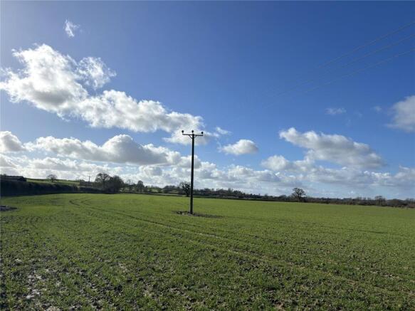
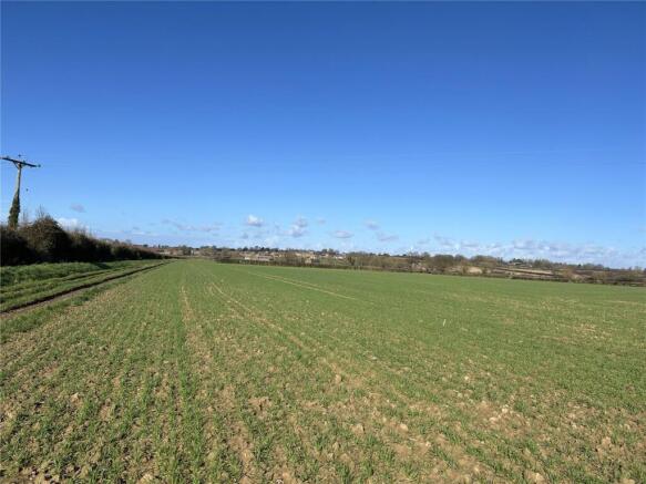
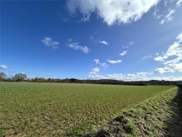
Block of productive arable land extending to approximately 127 acres (51.40 ha).
Available as a whole on a 3 year Farm Business Tenancy Agreement.
TENDERS TO BE SUBMITTED BY 12 NOON ON FRIDAY 2ND MAY 2025
DESCRIPTION
This presents an exciting opportunity to rent a substantial block of productive arable land on the outskirts of Martock. The land is to be let as a whole on an initial 3 year Farm Business Tenancy Agreement, commencing on 1st October 2025.
The holding comprises a mixture of grass leys, maize stubble and wheat crops bordered by mature hedgerow boundaries and stock proof fencing in part. There is a more detailed schedule of each field parcel overleaf.
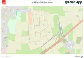
The land can be identified on the attached site plan.
METHOD OF LETTING
The holding will be let under the terms of a Farm Business Tenancy from 1st October 2025 for a period of 3 years.
Application forms must be completed in full and returned with any supporting documentation by 12 noon on Friday 2nd May 2025 to FAO Gemma Bluck Greenslade Taylor Hunt, 22 Princess Street, Yeovil, Somerset, BA20 1EQ marked “Land at Stoke Road” or by email to gemma.
Please find the tender forms attached.
CONDITION OF LETTING
The successful applicant will be eligible to enter the land from 1st October 2025 having paid the first months rent in advance by standing order.
The tenancy will be a full repair and maintenance responsibility to the Tenant.
The Tenant will use the holding for agricultural purposes only and will not be permitted to sublet the land or sell the crops to a third party unless the Landlord gives written consent in advance.
SERVICES
Mains water is available to connect.
RIGHTS OF WAY, EASEMENTS, ETC.
A public footpath (ST|Y|16/20) exists along the eastern boundary of field parcel ST4618 4042 and traverses the centre of parcels ST4618 4823 and ST4618 5004.
A public footpath (ST|Y|16/35) also runs along the northern boundary of field parcel ST4618 2417, shown as letter G on the attached site plan.
AGRI - ENVIRONMENTAL LAND SCHEMES
The land is not currently entered into any Countryside Stewardship Mid-Tier / Higher Tier, Sustainable Farming Incentive, or other Environmental Land Management Schemes. The Tenant will be able to enter into the Expanded Sustainable Farming Incentive subject to approval of the proposed scheme by the Landlord and honouring the prescriptions of Tenancy agreement.
RECORD OF CONDITION
A record of condition has been produced and the Tenant will be responsible for all maintenance and repairs, such as cutting of hedges and any repair of the gateways.
AGENTS NOTE
The Landlord reserves the right to retain the shooting rights over the land.
The Landlord reserves the right to take back in hand a section of the land being no more than 10% of the total area, subject to gaining any necessary planning consents.
ACCESS
The land is accessed via a concrete trackway directly from Stoke Road, followed by various gateways into the land, as shown shaded blue on the attached site plan.
LAND SCHEDULE
Please refer to the Tender Pack for a detailed Land Schedule and corresponding Site Plan.
NOTICE FOR GUIDANCE FOR PROSPECTIVE TENANTS
All prospective Tenants must satisfy themselves by inspection or otherwise the accuracy of the statements contained within these particulars.
DIRECTIONS
From Stapleton cross roads, head south along North Street for approximately 1.2 miles until you reach a mini roundabout. Take the first exit onto Stoke Road and continue on this road for approximately 0.8 miles. The track to the land will be on the right hand side with a concrete gateway. It will be indicated by a GTH ’To Let’ Marketing Board.
From Yeovil Coopers Mill roundabout, head west along Lysander Road for approximately 1.2 miles. Go straight ahead at the traffic lights and continue until you reach a roundabout. Take the first exit onto the A3088 and stay on this road for approximately 4 miles. Take the first exit at Cartgate roundabout. Turn left onto the first slip road and bear round to the left. Take the left hand turning at the Junction and continue for approximately 0.3 miles. The gateway to the track will be immediately on the left hand, side indicated by a GTH ’To Let’ Marketing Board.
Sat Nav: TA12 6RR
WHAT.3.WORDS
For the exact location download the app and enter;
///evolution.wedding.moderated
DESIGNATIONS
We are not aware of any designations affecting the property.
VIEWINGS
The land can be viewed on foot at any reasonable time with a copy of these particulars in hand. Please observe the country code and ensure all gates are closed.
SOIL TEST RESULTS
We hold a copy of the most recent soil test results. Please contact the agent for further details.
Brochures
ParticularsStoke Road, Martock, Somerset, TA12

NEAREST STATIONS
Distances are straight line measurements from the centre of the postcode- Crewkerne Station6.3 miles


Notes
Disclaimer - Property reference YEA250018_L. The information displayed about this property comprises a property advertisement. Rightmove.co.uk makes no warranty as to the accuracy or completeness of the advertisement or any linked or associated information, and Rightmove has no control over the content. This property advertisement does not constitute property particulars. The information is provided and maintained by Greenslade Taylor Hunt, Yeovil. Please contact the selling agent or developer directly to obtain any information which may be available under the terms of The Energy Performance of Buildings (Certificates and Inspections) (England and Wales) Regulations 2007 or the Home Report if in relation to a residential property in Scotland.
Map data ©OpenStreetMap contributors.