
Church Lane, Huxley, CH3
- PROPERTY TYPE
Land
- SIZE
Ask agent

Key features
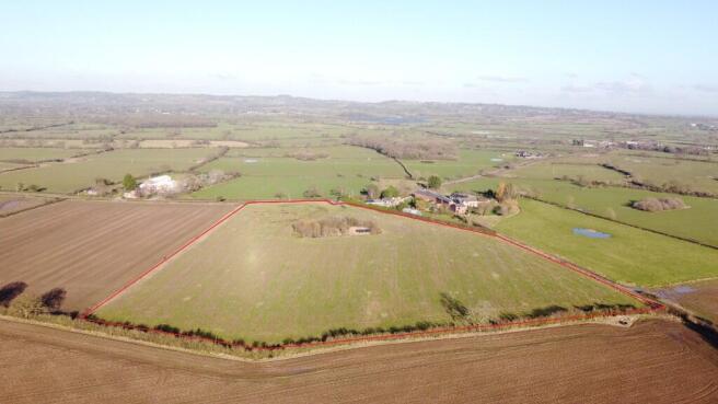
- Productive agricultural land extending to 12.69 acres (5.14 ha) with in-field pond
- Suitable for multiple uses including arable/grass production as well as equestrian and leisure activities with good road access
Description
SUMMARY
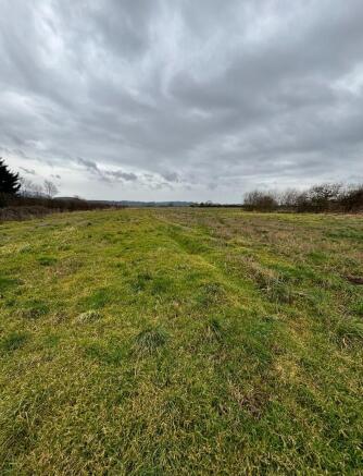
A block of productive agricultural land extending to 12.69 acres (5.14 ha) with in-field pond. The field would be suitable for multiple uses including arable/ grass production, equestrian and leisure activities with good road access.
DIRECTIONS
From the A49 coming from Bunbury Heath take the left turn towards Tiverton. Follow Huxley Lane which in Brassey Green goes into Church Lane. Approximately 2.5 miles from Tiverton the access track will be located on the left-hand side with a Rostons for sale board.
What3words- ///extension.husband.headset
VIEWINGS
The land can be viewed at any reasonable time without prior appointment with the selling agent. We request that you take a copy of these sales details with you when viewing the land.
TENURE & TITLE
Freehold with vacant possession upon completion.
OVERAGE
The land will be sold subject to an overage provision where the vendor will be entitled to 25% of the uplift in value resulting in any use other than agricultural or equestrian. This will be in place for 25 years. This will be triggered upon the grant of planning or if any change of use is implemented.
SERVICES
There are no services to the land.
SOIL TYPE LAND GRADE
According to the Cranfield Soil and Agri-food Institute (Soilscapes of England & Wales), the soil is classed as "Soilscape 18" described as slowly permeable seasonally wet slightly acid but base-rich loamy and clayey soils. The land is Grade 3 (Land Classification Series for England & Wales) (Grade 1 - best, Grade 5 - worst).
FENCING
The fencing and boundaries will be the responsibility of the purchaser.
TOWN AND COUNTRY PLANNING ACT
The property not withstanding any description contained in these particulars, is sold subject to any development plan, tree preservation order, town planning scheme or agreement, resolution or notice.
SALE PLAN AND PARTICULARS
The sale plan is based on the Ordnance Survey sheet. Prospective purchasers should check the contract documents. The purchasers shall raise no objection or query in respect of any variation between the physical boundaries and the Ordnance Survey sheet plan. The plans are strictly for identification purposes only.
MONEY LAUNDERING LEGISLATION
Rostons Ltd must comply with Anti Money Laundering legislation. As part of the requirements, Rostons must obtain evidence of the identity & proof of address of potential buyers. Prior to an offer being accepted, all parties who are purchasing must provide the evidence.
EASEMENTS, WAYLEAVES AND RIGHTS OF WAY
The land is sold subject to and with the benefit of all public and private rights of way, lights, drainage, cable, pylons or other easements, restrictions or obligations whether or not the same are described in these particulars of sale.
ACCESS
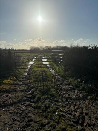
Access to land is via a short agriculture track off church lane
SELLING AGENTS
James Parton
Rostons Ltd
West View House
Hatton Heath
Chester
CH3 9AU
Tel:
Email:
Brochures
Brochure 1Church Lane, Huxley, CH3

NEAREST STATIONS
Distances are straight line measurements from the centre of the postcode- Mouldsworth Station6.2 miles

About Rostons, Hatton Heath
West View House Whitchurch Road, Hatton Heath, CH3 9AU
Notes
Disclaimer - Property reference CP16244. The information displayed about this property comprises a property advertisement. Rightmove.co.uk makes no warranty as to the accuracy or completeness of the advertisement or any linked or associated information, and Rightmove has no control over the content. This property advertisement does not constitute property particulars. The information is provided and maintained by Rostons, Hatton Heath. Please contact the selling agent or developer directly to obtain any information which may be available under the terms of The Energy Performance of Buildings (Certificates and Inspections) (England and Wales) Regulations 2007 or the Home Report if in relation to a residential property in Scotland.
Map data ©OpenStreetMap contributors.