
Wolverton Common, Tadley, Hampshire, RG26

- PROPERTY TYPE
Plot
- SIZE
Ask agent
Description
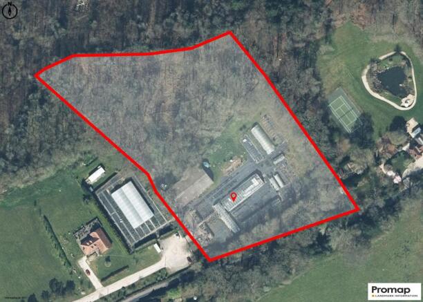
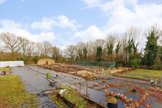
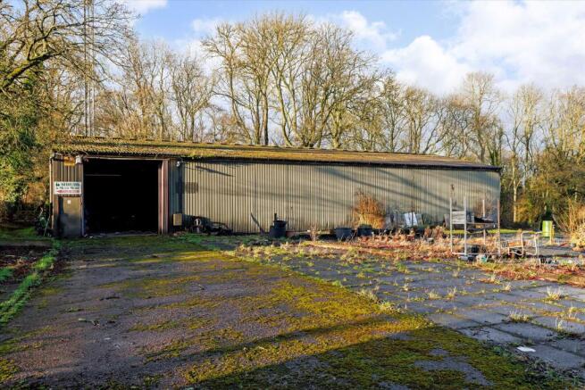
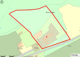
The site has mains electricity and water, as well as private drainage. There is also fibre broadband in road and into the entrance. Covering approximately four acres, the property has access from Wolverton Road to the southwest.
There is permission in principle for residential development, allowing a minimum of one and maximum of two dwellings. Which is subject to a list of expectations that need to be submitted at the technical design stage.
For more information please refer to the Basingstoke and Deane Planning Reference for this development REF: 22/03265/PIP.
Services: Mains water and electricity. Private drainage. Fibre Broadband.
Local Authority: Basingstoke and Deane
Tax Band: N/a
Tenure: Freehold
Postcode: RG26 5RU
The plot is located in the hamlet of Wolverton, which lies midway between the towns of Basingstoke and Newbury. Within the vicinity is St Catherine's Church, Hampshire Deli and Farm Shop, and Wolverton Village Hall. This a rural location with local hamlets and villages in the vicinity that offer amenities, such as Charter Alley, Ramsdell and nearby Kingsclere (all within around 5 miles) which offer shops, including a butcher, post office, restaurants, public houses, a doctor's surgery and a veterinary surgery.
More extensive facilities can be found in Newbury (12.8 miles) and Basingstoke (5.8 miles).
There is a regular rail service to London Waterloo from Basingstoke (from 42 minutes) and London Paddington from Newbury (from 40 minutes). The M3 and M4 are easily accessible.
There is choice of well-regarded independent schools in the area including Cheam, Elstree, Wellesley Prep, Bradfield. Further schools include Kingsclere Primary School, Ashford Hill Primary in Thatcham and Bishopswood Infant and Junior School in Tadley.
The surrounding countryside is beautiful with plenty of footpaths and bridleways.
(All distances and times are approximate.)
Brochures
More DetailsPlot_at_The_Barn_WolWolverton Common, Tadley, Hampshire, RG26

NEAREST STATIONS
Distances are straight line measurements from the centre of the postcode- Thatcham Station5.0 miles
- Midgham Station5.0 miles
- Overton Station5.5 miles


Notes
Disclaimer - Property reference BSK012451650. The information displayed about this property comprises a property advertisement. Rightmove.co.uk makes no warranty as to the accuracy or completeness of the advertisement or any linked or associated information, and Rightmove has no control over the content. This property advertisement does not constitute property particulars. The information is provided and maintained by Knight Frank, Covering North Hampshire. Please contact the selling agent or developer directly to obtain any information which may be available under the terms of The Energy Performance of Buildings (Certificates and Inspections) (England and Wales) Regulations 2007 or the Home Report if in relation to a residential property in Scotland.
Map data ©OpenStreetMap contributors.