Land and Bunker at Broadwater Down, Tunbridge Wells, Kent

- SIZE AVAILABLE
7,000 sq ft
650 sq m
- SECTOR
Commercial property for sale
Key features
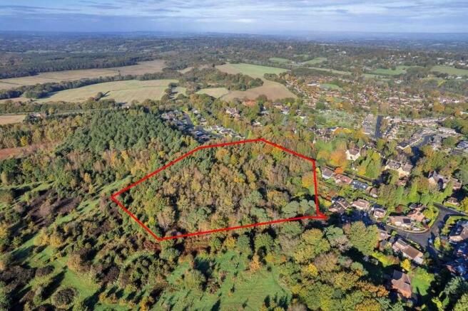
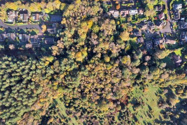
- 1.90 hectares (4.69 acres) of mixed broadleaf & conifer woodland within an AONB
- Two underground war time bunkers extending to around 7,000 square feet
- Urban fringe location with convenient access to surrounding towns and villages
- Future development opportunities*, subject to planning consent
- Unconditional offers invited
Description
The land also contains a subterranean network of bunkers and passages, some 60 feet below ground, built between 1940 and 1941 and occupied by members of the Royal Corps of Signals.
Three access points are recorded which are triangularly orientated to each other throughout the property and appear to comprise brick with single openings. All three accesses are permanently closed to prevent trespass.
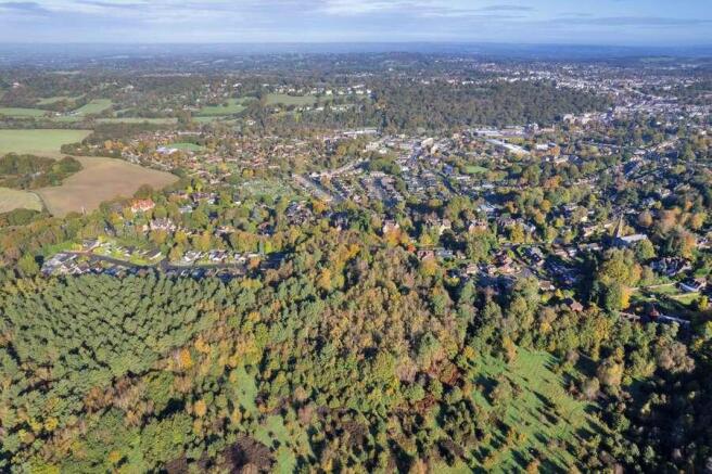
The property is located on the southern edge of Tunbridge Wells approximately 1.4 miles south-west of the town centre, 2.7 miles east of Groombridge and 2.25 miles north-west of the village of Bells Yew Green.
The land is bounded by Broadwater Down to the north, residential development on Strawberry Close to the west and Hargate Close to the east, to the south is Hargate Forest.
Brochures
Land and Bunker at Broadwater Down, Tunbridge Wells, Kent

NEAREST STATIONS
Distances are straight line measurements from the centre of the postcode- Tunbridge Wells Station1.2 miles
- Frant Station2.2 miles
- Eridge Station2.7 miles
Notes
Disclaimer - Property reference 8827A227-C6A9-4473-9094-2133309BB65B. The information displayed about this property comprises a property advertisement. Rightmove.co.uk makes no warranty as to the accuracy or completeness of the advertisement or any linked or associated information, and Rightmove has no control over the content. This property advertisement does not constitute property particulars. The information is provided and maintained by Savills, Sevenoaks. Please contact the selling agent or developer directly to obtain any information which may be available under the terms of The Energy Performance of Buildings (Certificates and Inspections) (England and Wales) Regulations 2007 or the Home Report if in relation to a residential property in Scotland.
Map data ©OpenStreetMap contributors.