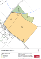
Land At Bretforton, Evesham, Worcestershire

- PROPERTY TYPE
Land
- SIZE
2,037,301 sq ft
189,272 sq m
Description
Method of sale: The land at Bretforton is offered for sale as a whole by private treaty.
Wayleaves, easements and rights of way: The property is being sold subject to and with the benefit of all rights including; rights of way, whether public or private, light, support, drainage, water and electricity supplies and other rights and obligations, easements and quasi-easements and restrictive covenants and all existing and proposed wayleaves for masts, pylons, stays, cables, drains, water and gas and other pipes whether referred to in these particulars or not.
Designations: The land lies within a Nitrate Vulnerable Zone (NVZ). We are not aware of any other designations affecting the land.
Holdover: A period of holdover may be required to permit the harvesting of all growing crops, subject to the timing of completion. Further information is available from the vendor’s agent.
Sporting, timber and mineral rights: All sporting, timber and mineral rights are included in the freehold sale, in so far as they are owned.
Overage: An overage clause shall apply to the land with further details available from the vendor’s agent upon request.
Environment Schemes: The land has historically been registered for payments under the Basic Payment Scheme and all delinked payments and entitlements relevant to the land will not be available to the Purchaser on completion of the sale.
Services: We have not been made aware of any services connected to the land.
Covenants and/or restrictions: There are restrictions/covenants listed on the Land Registry Title deed. Further details are available upon request from the vendor’s agent.
Fixtures and fittings: All items usually regarded as fixtures and fittings and equipment are specifically excluded from the sale.
Local authority: Wychavon District Council (wychavon.gov.uk); Worcestershire County Council (worcestershire.gov.uk).
VAT: Any guide price quoted or discussed is exclusive of VAT. In the event that a sale of the property, or any part of it, or any right attached to it, becomes a chargeable supply for the purposes of VAT, such tax will be payable in addition.
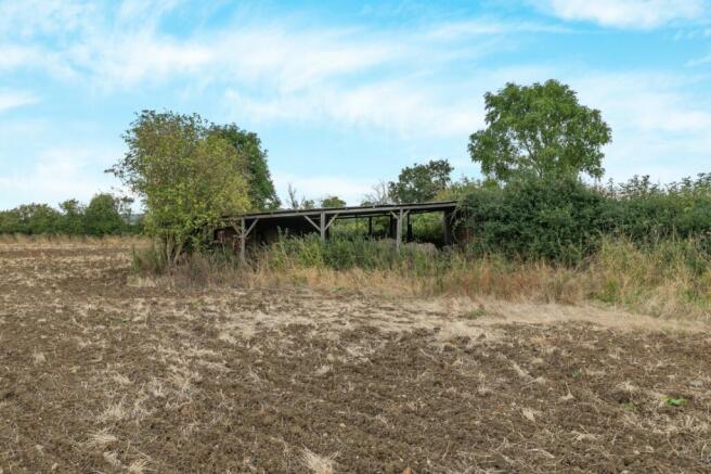
Health and safety: Given the potential hazards of a working farm we ask you to be as vigilant as possible when making your inspection for your own personal safety, particularly around the farm buildings and machinery.
Solicitors: Wright Hassall, Olympus Ave, Royal Leamington Spa, CV34 6BF
Postcode: WR11 7HN
What3words: ///domain.manager.fruit
Guide Price: £500,000
Directions: From Chipping Campden take the B4035 Weston Road towards Bretforton, on entering the village of Bretforton access to the land is situated directly on the right-hand side.
Viewing: Strictly by confirmed appointment with the vendor’s agents, Strutt & Parker in Cirencester
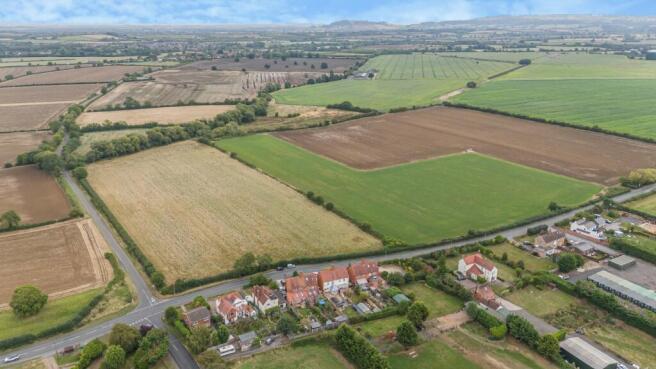
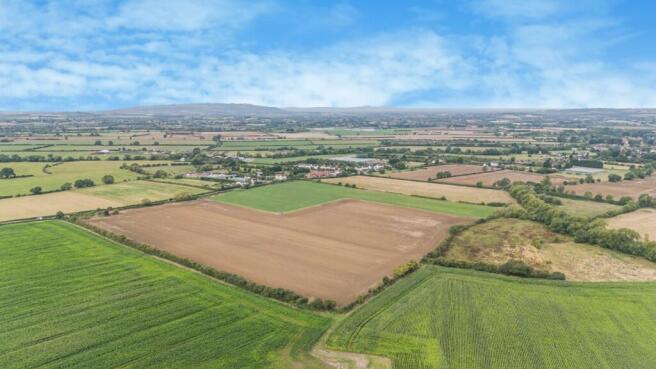
The land is well located 0.5 miles to the southeast of the village of Bretforton, approximately 4 miles east of Evesham in Worcestershire. The land benefits from road frontage with access directly taken from Weston Road (B4035) to the south and Gloster Ades Road to the west.
Brochures
Web DetailsParticularsLand At Bretforton, Evesham, Worcestershire

NEAREST STATIONS
Distances are straight line measurements from the centre of the postcode- Honeybourne Station1.4 miles
- Evesham Station4.2 miles
Notes
Disclaimer - Property reference CFA240001. The information displayed about this property comprises a property advertisement. Rightmove.co.uk makes no warranty as to the accuracy or completeness of the advertisement or any linked or associated information, and Rightmove has no control over the content. This property advertisement does not constitute property particulars. The information is provided and maintained by Strutt & Parker, Central Estates & Farm Agency. Please contact the selling agent or developer directly to obtain any information which may be available under the terms of The Energy Performance of Buildings (Certificates and Inspections) (England and Wales) Regulations 2007 or the Home Report if in relation to a residential property in Scotland.
Map data ©OpenStreetMap contributors.