
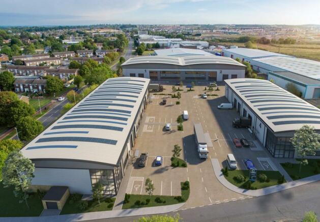

Units 3-8 Marston Business Park, 1 Marston Road, St Neots, PE19 2HN

- SIZE AVAILABLE
5,145-16,745 sq ft
478-1,556 sq m
- SECTOR
Light industrial facility to lease
Lease details
- Lease available date:
- Ask agent
Key features
- 8m eaves height
- Units 3/4 - 4 loading doors, Units 5-8 - 1 loading door
- 17m yard depth
- EV charging points - 20% of parking
- Use classes: E/B2/B8
Description
St Neots is ideally located in the Oxford-Cambridge Arc surrounded by universities, Science Parks, and research and Technology Zones. It is therefore ideal for supply chain partners/suppliers/producers that will benefit from the economic growth that the Arc provides.
A428 Dual Carriageway Black Cat - Caxton Gibbett Bypass
Connectivity will further improve with the A428 dual carriageway upgrade.
The new 10-mile dual carriageway will link the A1 Black Cat roundabout near St Neots and the A428 Caxton Gibbet near Cambridge.
Connectivity will further improve with the A428 dual carriageway upgrade.
The new 10-mile dual carriageway will link the A1 Black Cat roundabout near St Neots and the A428 Caxton Gibbet near Cambridge.
St Neots is expected to be in close proximity to the UK’s first ‘Drone Superhighway’. The route will connect Cambridge & Oxford and Reading & Coventry. The infrastructure is due to be delivered in 2024.
Specifications
- 8m eaves height
- Units 3/4 - 4 loading doors, Units 5-8 - 1 loading door
- 17m yard depth
- 20% of parking EV charging points
- Use E/B2/B8
Travel
St Neots Train
Peterborough - 24 mins
Stevenage - 28 mins
London St Pancras (Intl) - 55 mins
London Kings Cross - 63 mins
Welwyn Garden City - 63 mins
Drive Times
A428 Bypass - 2 miles - 5 mins
A1(M) - 3 miles - 11 mins
M11 - 15 miles - 21 mins
M25 J23 - 42 miles - 54 mins
M1 - 52 miles - 58 mins
Cities/Towns
Cambridge - 18 miles 34 mins
Peterborough - 29 miles - 40 moms
Northampton - 35 miles - 54 mins
Oxford - 68 miles - 95 mins
London - 58 miles - 104 mins
Airports/Ports
Luton Airport - 34 miles - 54 mins
Stansted Airport - 44 miles - 60 mins
Heathrow Airport - 70 miles - 75 mins
London Gateway - 81 miles - 90 mins
Felixstowe - 86 miles - 94 mins
Brochures
Units 3-8 Marston Business Park, 1 Marston Road, St Neots, PE19 2HN

NEAREST STATIONS
Distances are straight line measurements from the centre of the postcode- St. Neots Station0.8 miles
Notes
Disclaimer - Property reference 138329-2. The information displayed about this property comprises a property advertisement. Rightmove.co.uk makes no warranty as to the accuracy or completeness of the advertisement or any linked or associated information, and Rightmove has no control over the content. This property advertisement does not constitute property particulars. The information is provided and maintained by Jones Lang Lasalle, East London - Industrial. Please contact the selling agent or developer directly to obtain any information which may be available under the terms of The Energy Performance of Buildings (Certificates and Inspections) (England and Wales) Regulations 2007 or the Home Report if in relation to a residential property in Scotland.
Map data ©OpenStreetMap contributors.