Land At Raw Cottages, East Calder, EH53
Business rates & charges may apply

- SIZE
Ask agent
- SECTOR
Farm for sale
Key features
- Great location
- Land with development potential, subject to obtaining the necessary consents
- Established community
- Village amenities nearby
Description
(together with Mid and West Calder), three small neighbouring communities situated west
of Edinburgh and south of the “New Town” of Livingston. The property is ideally situated for
the commuter to Edinburgh and Glasgow. There is an excellent bus service which links the
village with the Edinburgh City Centre. The property is within easy reach of the A71 and M8
motorway network, with the local train station at Kirknewton and Edinburgh airport a short
drive away. East Calder has three primary schools, the non-denominational East Calder and
Calderwood Primary Schools, and St Paul’s RC School. The non-denominational schools are
in the catchment area for West Calder High School, while St Paul’s is in the catchment for
St Margaret’s Academy, served by a school bus. The village also has its own nursery. There
is a leisure centre and lots of local amenities, including a doctors’ surgery, a dentist, a post
office, a Tesco local, 2 Co-op mini supermarkets, hairdressers, a local pub and takeaways.
More facilities can also be found a few minutes away in the village of Mid Calder, with a
short drive to Livingston which offers a wide range of shops in two main shopping centres
and various retail parks
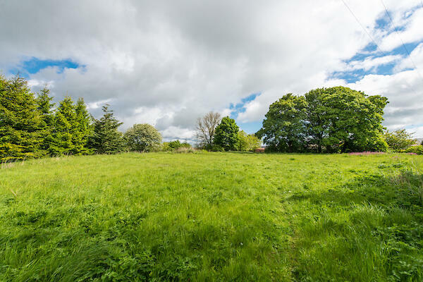
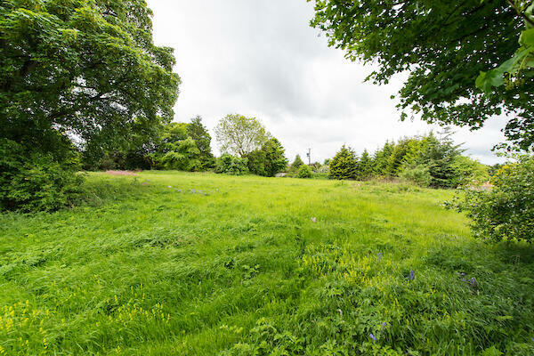
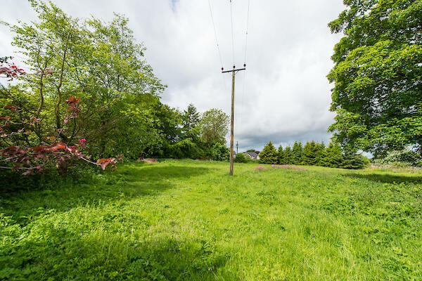
A unique opportunity to acquire a parcel of land in the heart of East Calder. This land parcel
is understood to have previously served as a quarry site. The site may represent suitability
for smallholding, equestrian or development subject to obtaining the necessary consents.
No site investigation reports or technical information remain publicly available on the
planning portal from a previous application, however a request for such information may be
made to the local authority. The previous planning reference is 0109/FUL/19. A third party
owns the road to the west (a right of access is granted over) and further lands north of this
property, contact details for the owners are available through the selling agents. Purchasers
should familiarise themselves with the most up to date information from SEPA: https://
of Sale
There are two areas identified as being at low risk of surface water flooding. Whilst it
is recognised that the land may represent development value, the site is not currently
allocated for development. Purchasers should seek advice in relation to long term prospects,
particularly in relation to current key policies and environmental factors concerning
previous quarry use. A boundary fence will be erected by the purchaser of North Cottage
which was recently marketed for sale. Purchasers will need to make their own enquiries
regarding service connections.
Brochures
Land At Raw Cottages, East Calder, EH53

NEAREST STATIONS
Distances are straight line measurements from the centre of the postcode- Kirknewton Station1.0 miles
- Uphall Station2.3 miles
- Livingston South Station2.9 miles
About DM Hall, Bridge of Allan
Station Road, Bridge Of Allan, Stirling, FK9 4JS
Notes
Disclaimer - Property reference Rural992221. The information displayed about this property comprises a property advertisement. Rightmove.co.uk makes no warranty as to the accuracy or completeness of the advertisement or any linked or associated information, and Rightmove has no control over the content. This property advertisement does not constitute property particulars. The information is provided and maintained by DM Hall, Bridge of Allan. Please contact the selling agent or developer directly to obtain any information which may be available under the terms of The Energy Performance of Buildings (Certificates and Inspections) (England and Wales) Regulations 2007 or the Home Report if in relation to a residential property in Scotland.
Map data ©OpenStreetMap contributors.