Charfield Hill, Charfield, GL12

- PROPERTY TYPE
Detached
- BEDROOMS
4
- BATHROOMS
3
- SIZE
Ask agent
- TENUREDescribes how you own a property. There are different types of tenure - freehold, leasehold, and commonhold.Read more about tenure in our glossary page.
Freehold
Key features
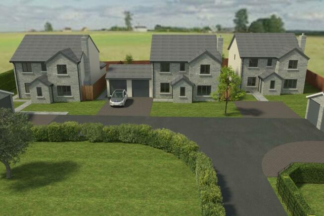
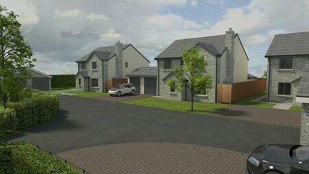
- Stunning Village Development Backing Onto Farmland
- Four Detached High-Specification Homes
- Kitchens Fitted With Quartz Worktops and NEEF Oven, Hob, Extractor, Fridge/Freezer, Dishwasher
- Air Source Heat Pump, plus ‘HETAS’ Installed Log-Burner
- Aluminium Bi-Fold Doors, UPVC Double-Glazing
- Gardens Laid To Turf, Paved Patio, Outside Tap, Outside Electrical Point
- Electric Gated Main Entrance
- EV Charging Point
- Houses With Electric Opening Double Garages
- 10-Year Build Zone Warranty
Description
‘The Walled Garden’ is an exclusive gated modern development, just waiting for discerning buyers to step in and make their personal choice of a luxury new home. Situated on Charfield Hill, four stunning properties comprising of three detached houses with double garages and one bungalow. Incorporating EV charging points and air-source heat pumps, taking a step into the green future ahead! The houses to the rear of the development, each with four bedrooms, twin en-suites and a double garage complete with electric doors, power and lighting. Modern fitted kitchens all round, with quartz worktops and integrated NEFF appliances incorporated as standard. Blessed with vaulted ceilings and bifold doors to gardens with an outlook across the fields behind and beyond, showing the true beauty of rural living. A unique two-bedroom bungalow (currently under offer) is situated at the front and ideal for those looking for single-level contemporary living. As a secondary heat source, each property has the added benefit of a HETAS Installed log Burner for cosy nights in on those chiller evenings of the year.
The village of Charfield is situated to the north of Thornbury and Chipping Sodbury on the B4058, approximately 2.5 mile from Junction 14 of the M5 at Falfield, connecting from there directly to Bristol in the south and Cheltenham/Gloucester to the north. The local centre of Wotton-under-Edge is approximately 2.5 miles further to the east, passing the road to Katharine Lady Berkeley secondary school on route. Charfield has a primary school, a selection of shops, a post office, public houses, and a petrol station.
Brochures
Brochure 1- COUNCIL TAXA payment made to your local authority in order to pay for local services like schools, libraries, and refuse collection. The amount you pay depends on the value of the property.Read more about council Tax in our glossary page.
- Band: TBC
- PARKINGDetails of how and where vehicles can be parked, and any associated costs.Read more about parking in our glossary page.
- Yes
- GARDENA property has access to an outdoor space, which could be private or shared.
- Yes
- ACCESSIBILITYHow a property has been adapted to meet the needs of vulnerable or disabled individuals.Read more about accessibility in our glossary page.
- Ask agent
Energy performance certificate - ask agent
Charfield Hill, Charfield, GL12
NEAREST STATIONS
Distances are straight line measurements from the centre of the postcode- Yate Station6.1 miles
Notes
Staying secure when looking for property
Ensure you're up to date with our latest advice on how to avoid fraud or scams when looking for property online.
Visit our security centre to find out moreDisclaimer - Property reference 27970300. The information displayed about this property comprises a property advertisement. Rightmove.co.uk makes no warranty as to the accuracy or completeness of the advertisement or any linked or associated information, and Rightmove has no control over the content. This property advertisement does not constitute property particulars. The information is provided and maintained by Milburys, Wotton-Under-Edge. Please contact the selling agent or developer directly to obtain any information which may be available under the terms of The Energy Performance of Buildings (Certificates and Inspections) (England and Wales) Regulations 2007 or the Home Report if in relation to a residential property in Scotland.
*This is the average speed from the provider with the fastest broadband package available at this postcode. The average speed displayed is based on the download speeds of at least 50% of customers at peak time (8pm to 10pm). Fibre/cable services at the postcode are subject to availability and may differ between properties within a postcode. Speeds can be affected by a range of technical and environmental factors. The speed at the property may be lower than that listed above. You can check the estimated speed and confirm availability to a property prior to purchasing on the broadband provider's website. Providers may increase charges. The information is provided and maintained by Decision Technologies Limited. **This is indicative only and based on a 2-person household with multiple devices and simultaneous usage. Broadband performance is affected by multiple factors including number of occupants and devices, simultaneous usage, router range etc. For more information speak to your broadband provider.
Map data ©OpenStreetMap contributors.
