
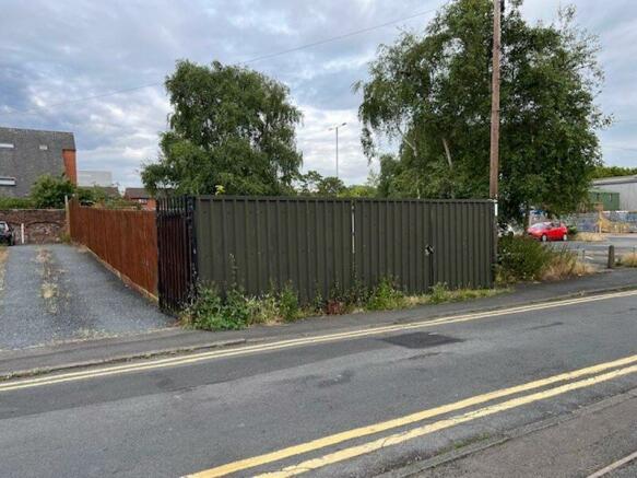
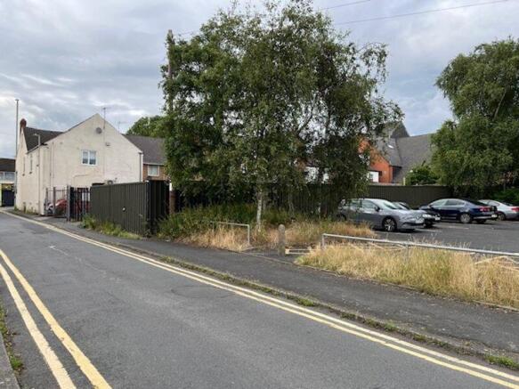

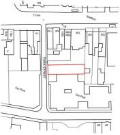
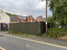
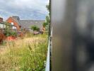
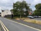
Park Street, Amblecote, Stourbridge

- PROPERTY TYPE
Land
- SIZE
Ask agent

Key features
- Building plot with planning consent for a detached bungalow
- Planning Application Ref P23/1582 approved with conditions
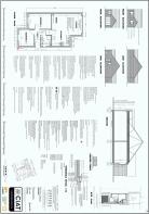
- Proposed layout for open plan lounge/dining/kitchen
- Two bedrooms and shower room
- Approximately 651sqft (60.5aqm)
- Conveniently located close to local amenities at Amblecote
Description
A rare opportunity to purchase a building plot with the benefit of planning consent for the erection of one detached bungalow. Planning application reference P23/1582 approved with conditions.
The proposed layout provides for entrance hall, two bedrooms, open plan lounge/ dining kitchen, and shower room. Gross internal area is approximately 60.5 m2. (651 ft2)
Conveniently located close to local amenities at Amblecote with shops at Brettle Lane including an Aldi supermarket within a short walking distance, a Tesco express and, a pharmacy etc.
Park Street itself is located between Brettle Lane and King William Street and is close to Public car parking.
Brochures
Property BrochureFull DetailsPlanning DocumentsPark Street, Amblecote, Stourbridge

NEAREST STATIONS
Distances are straight line measurements from the centre of the postcode- Stourbridge Town Station1.2 miles
- Stourbridge Junction Station1.8 miles
- Lye Station1.8 miles
About The Lee Shaw Partnership, Hagley
Kempson House, 101 Worcester Road, Hagley, DY9 0NG


Notes
Disclaimer - Property reference 12432918. The information displayed about this property comprises a property advertisement. Rightmove.co.uk makes no warranty as to the accuracy or completeness of the advertisement or any linked or associated information, and Rightmove has no control over the content. This property advertisement does not constitute property particulars. The information is provided and maintained by The Lee Shaw Partnership, Hagley. Please contact the selling agent or developer directly to obtain any information which may be available under the terms of The Energy Performance of Buildings (Certificates and Inspections) (England and Wales) Regulations 2007 or the Home Report if in relation to a residential property in Scotland.
Map data ©OpenStreetMap contributors.