Hodgeston
- PROPERTY TYPE
Land
- SIZE
1,445,321 sq ft
134,275 sq m
Key features
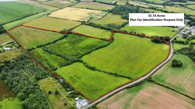
- 33.18 Acres of good quality agricultural land
- Ideal for general grazing/silage etc or arable purposes
- Situated conveniently off the A4139 road linking the villages of Hodgeston to Jameston in south Pembrokeshire
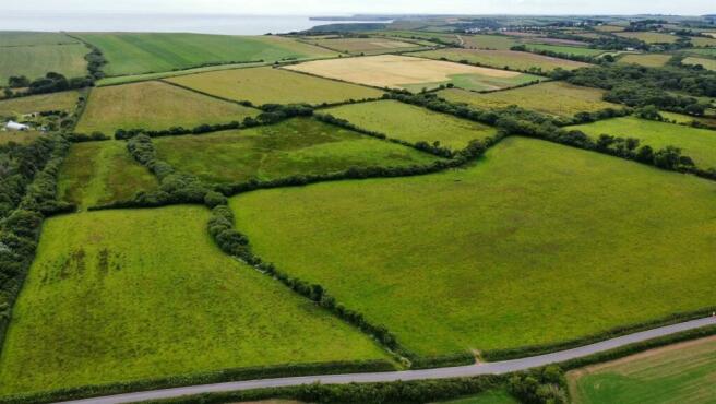
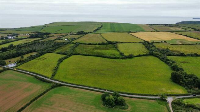
- The land is level/gently sloping and comprise a block of 5 adjoining fields
- Gated roadside access
- No services connected
Description
Description - A parcel of excellent agricultural land, comprising 5 level/gently sloping adjoining fields with roadside gated access. Ideal multi use land for grazing/arable use.
Situation - The land is very well located and easily accessed, being situated in an area well known for prime agricultural land, between the 2 villages of Hodgeston and Jameston, south Pembrokeshire.
Services - There are no services connected.
Tenure - Freehold
Directions - What3words: ///abstracts.flooding.recorders
From Hodgeston, proceed on the A4139 in the direction of Jameston. The land is found on the right hand side, as identified by our JJMorris for sale sign. Gated access leads directly onto the A4139 road.
Brochures
HodgestonBrochureHodgeston

NEAREST STATIONS
Distances are straight line measurements from the centre of the postcode- Lamphey Station1.2 miles
- Manorbier Station2.5 miles
- Pembroke Station2.6 miles

Notes
Disclaimer - Property reference 33214770. The information displayed about this property comprises a property advertisement. Rightmove.co.uk makes no warranty as to the accuracy or completeness of the advertisement or any linked or associated information, and Rightmove has no control over the content. This property advertisement does not constitute property particulars. The information is provided and maintained by JJ Morris, Narberth. Please contact the selling agent or developer directly to obtain any information which may be available under the terms of The Energy Performance of Buildings (Certificates and Inspections) (England and Wales) Regulations 2007 or the Home Report if in relation to a residential property in Scotland.
Map data ©OpenStreetMap contributors.