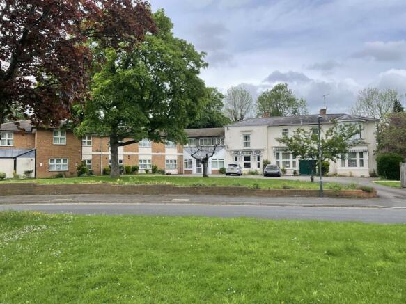
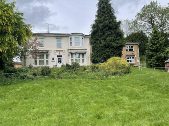
Cedar Lawn, Cedar Close, Stratford-Upon-Avon, CV37 6UP
- SIZE AVAILABLE
55,321 sq ft
5,140 sq m
- SECTOR
Healthcare facility for sale
Key features
- Freehold Property
- Site Area of approx. 1.27 acres (0.51 ha) gross
- Use Class C2, suitable for a variety of uses (STPP)
- Established Residential Area
Description
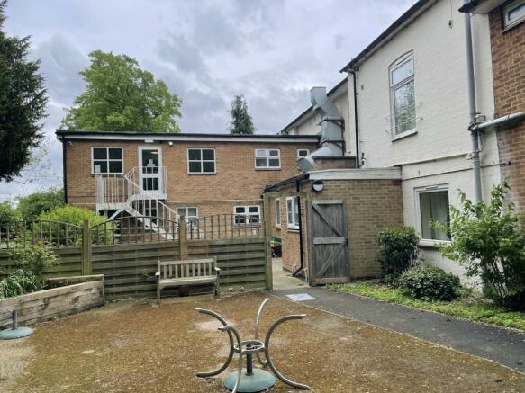
The care home comprises a two-storey detached building extending to approx. 17,577 sq ft (1,633 sqm) GIA. It occupies a roughly rectangular plot extending to approx. 1.27 acres (0.51 ha) gross.
The property has been used as a care home since c. 1970 and is now vacant. We understand that it was originally a large family home which has been significantly extended to provide accommodation for up to 37 residents. The western wing was built in 1997 and a former bungalow was extended to link to the care home.
The building occupies the western half of the site with the eastern half comprising of mature gardens. The site has a wide frontage onto Cedar Close being set back behind a lawn area and parking which extends to one side. We consider the property to have good reuse/redevelopment potential (STPP).
Vacant possession will be provided on completion of the transaction.
Location
The property is located approximately 0.4 miles to the north-east of Stratford-upon-Avon town centre.
Stratford-upon-Avon is a market town in Warwickshire, 21 miles (34 km) to the south-east of Birmingham, 18 miles (29 ha) to the southwest of Coventry and 36 miles (58 ha) to the north-west of Oxford.
The property is located in Cedar Close a small residential cul-de-sac comprising the care home and five residential bungalows. Cedar Close is accessed from Welcombe Road which connects with the Warwick Road (A439).
Stratford-upon-Avon town centre provides a broad range of amenities including national retailers and independent shops and cafes.
There are also nine schools within 1 mile of the property, two of which have an Ofsted rating of 'Excellent'.
Viewings
It is intended that a number of accompanied viewing days will be arranged.
Parties should contact Avison Young to arrange an inspection. No attempt should be made to gain access to the property without prior arrangement.
EPC
A copy of the property's EPC is available upon request. The property has an C (54) Energy Rating.
Local Authority
Stratford-on-Avon
Services and Planning
We understand that all mains services are available to the property. However, prospective purchasers must satisfy themselves in respect of the availability, capacity and sustainability of all services and utilities.
The Local Planning Authority is Stratford-on-Avon District Council.
The current planning use for the site is considered to be Use Class C2, residential care home. We consider the property suitable for a variety of alternative uses, subject to planning permission.
Parties are encouraged to make their own enquiries with the local authority.
Brochures
Cedar Lawn, Cedar Close, Stratford-Upon-Avon, CV37 6UP

NEAREST STATIONS
Distances are straight line measurements from the centre of the postcode- Stratford-upon-Avon Station0.7 miles
- Stratford-upon-Avon Parkway Station1.5 miles
- Wilmcote Station2.9 miles
About Avison Young (UK) Limited, Land & Development
65 Gresham Street, London, EC2V 7NQ
Notes
Disclaimer - Property reference 217439-1. The information displayed about this property comprises a property advertisement. Rightmove.co.uk makes no warranty as to the accuracy or completeness of the advertisement or any linked or associated information, and Rightmove has no control over the content. This property advertisement does not constitute property particulars. The information is provided and maintained by Avison Young (UK) Limited, Land & Development. Please contact the selling agent or developer directly to obtain any information which may be available under the terms of The Energy Performance of Buildings (Certificates and Inspections) (England and Wales) Regulations 2007 or the Home Report if in relation to a residential property in Scotland.
Map data ©OpenStreetMap contributors.