Easter Board Farm, Croy, Glasgow, East Dunbartonshire, G65

- PROPERTY TYPE
Land
- SIZE
1,799,464 sq ft
167,176 sq m
Description
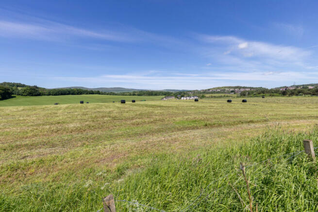
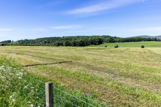
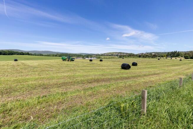
The land extends to about 16.72 ha (41.31 acres) which is divided into three fields.
Elevation, Topography and Rainfall
Located to the west side of Howe Road, immediately north of the railway line, the fields lie between the heights of 65m and 75m above sea level. The area is shown on the Meteorological Office Average Rainfall Chart in the region of 1153mm per annum.
Land Capability for Agriculture
The land is shown on the James Hutton Institute Land Capability for Agriculture Plans as being of Class 3.2 capable of average production, though high yields of barley, oats and grass.
Soil Type
The predominant soil type is brown earths which is part of the Rowanhill Soil Association.
Drainage/Flood Risk
The indicative SEPA Flood Risk Maps show there is no specific risk of river or surface water flooding.
Boundaries
The fields are bounded by stock proof fencing and the boundary to the north is formed by the Board Burn.
Wayleaves and Rights of Way
There is a wayleave in favour of SGN for a gas pipeline which cuts across the land.
Environmental Designations and Grant Schemes
The land does not lie within a Nitrate Vulnerable Zone (NVZ).
Cropping
Two of the fields are permanent pasture, with the middle field having been reseeded in 2022, with a red clover and rye grass mixture. The land has been used for silage to provide for a dairy herd.
Services to the land
There is an unmetered water pipe running along the farm track with a T junction in the middle of the field.
Health and Safety
The land is being worked and appropriate caution must always be exercised during viewings, especially when in the fields.
IACS
The fields are registered for IACS purposes. The farm code is 76/338/0025
Basic Payment Scheme (BPS) 2024
There are no BPS entitlements included in the sale.
Mineral Rights
The mineral rights are included.
Brochures
ParticularsEaster Board Farm, Croy, Glasgow, East Dunbartonshire, G65

NEAREST STATIONS
Distances are straight line measurements from the centre of the postcode- Croy Station0.7 miles
- Greenfaulds Station2.6 miles
- Cumbernauld Station3.0 miles
About the agent
Bell Ingram, Perth
Durn, Isla Road, Perth, PH2 7HF
A Team You Can Trust
We understand that the decision to sell is never easy. The relationship between our agents and clients is based on trust and our team will give you the confidence that we will be able to achieve the best outcome for you. Drawing on over 100 years' experience, our professionals ensure your expectations are exceeded.
Industry affiliations


Notes
Disclaimer - Property reference PER240034. The information displayed about this property comprises a property advertisement. Rightmove.co.uk makes no warranty as to the accuracy or completeness of the advertisement or any linked or associated information, and Rightmove has no control over the content. This property advertisement does not constitute property particulars. The information is provided and maintained by Bell Ingram, Perth. Please contact the selling agent or developer directly to obtain any information which may be available under the terms of The Energy Performance of Buildings (Certificates and Inspections) (England and Wales) Regulations 2007 or the Home Report if in relation to a residential property in Scotland.
Map data ©OpenStreetMap contributors.