
Garsdale, Sedbergh

- PROPERTY TYPE
Land
- SIZE
1,886,148 sq ft
175,229 sq m
Key features
- Allotment land extending to 43.30 acres
- Available as a whole or in up to four lots
Description
Tender Deadline: 12 Noon - Tuesday 9th July 2024
Viewing available - Thursday 20th June 12pm - 2pm
Approx. 43.30 acres (17.52ha) of allotment ground offering rough grazing and high value landscape. Set in an elevated position with roadside access from Coal Road.Nestled in the heart of the picturesque Yorkshire Dales National Park this traditional Dales farm offers an excellent opportunity to acquire a holding with scope and potential to create a perfect family home and / or run as a livestock unit. The property itself is a traditional Grade II listed Dales farmhouse with many original features and rustic charm, together with an attached stone barn, thought to be of Viking origin, which is ideal for a variety of uses from storage to potential conversion subject to the necessary planning consents. Beyond the immediate house and gardens is land to the south of the A684 extending to approximately 12.91 acres (5.22 hectares) leading down to the River Clough and to the north of the A684 can be found a further block of productive land extending to 49.36 acres (19.98 hectares). Some distance from the property, located above Garsdale station on the Coal Road is an allotment area of ground extending to 43.30 acres (17.52 hectares) which is ideal for those running the holding as a lifestyle unit.
Offered either as a whole or in lots, this property provides an opportunity for purchasers to acquire what they wish and is ideal for those looking for an idyllic rural life and / or for local agricultural interests to add to their existing holdings.
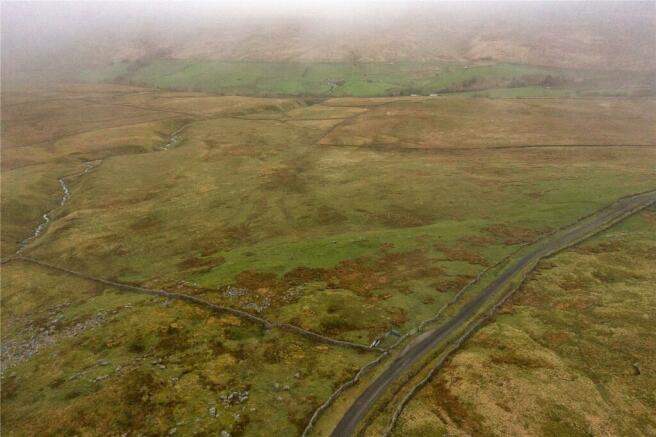
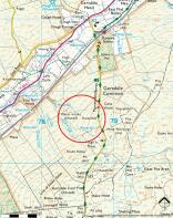
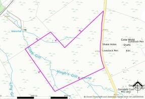
Lot 4 – Land Off Coal Road, Garsdale Extending to Approximately 43.30 acres (17.52 hectares)
Comprising approximately 43.30 acres (17.52) of rough grazing land situated in an elevated position set south of Garsdale railway station and accessed from the Coal Road which leads from the A684. The land comprises semi-natural permanent pasture and has landscape value, in good heart and is ideal for grazing of livestock. Natural water is available and the land is bordered with stock proof boundaries.
Brochures
ParticularsGarsdale, Sedbergh

NEAREST STATIONS
Distances are straight line measurements from the centre of the postcode- Dent Station3.2 miles
- Garsdale Station4.2 miles

About the agent
Armitstead Barnett, Cumbria
Lane Farm, Crooklands, LA7 7NH
Our aim is to provide bespoke and pro-active advice. We not only have traditional values and working methods available to us, but also our up-to-date technology and forward thinking which allows us to provide a truly tailored service to our clients through a good understanding of their needs.
Our Clients vary from private individuals through to large corporate companies and as an independent practice of Property Consultants we are full members of the Royal Institution
Notes
Disclaimer - Property reference KEN240133. The information displayed about this property comprises a property advertisement. Rightmove.co.uk makes no warranty as to the accuracy or completeness of the advertisement or any linked or associated information, and Rightmove has no control over the content. This property advertisement does not constitute property particulars. The information is provided and maintained by Armitstead Barnett, Cumbria. Please contact the selling agent or developer directly to obtain any information which may be available under the terms of The Energy Performance of Buildings (Certificates and Inspections) (England and Wales) Regulations 2007 or the Home Report if in relation to a residential property in Scotland.
Map data ©OpenStreetMap contributors.