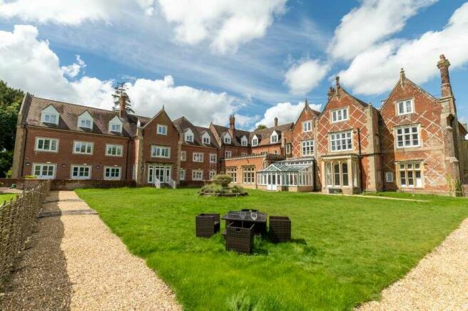
Former Youth Rehabilitation Centre in Hampshire For Sale, Grade II Listed property with modern extensions, set in c. 10.

- SIZE
Ask agent
- SECTOR
Healthcare facility for sale
Key features
- Development Potential for C1, C2, C3 or F1a use
Description
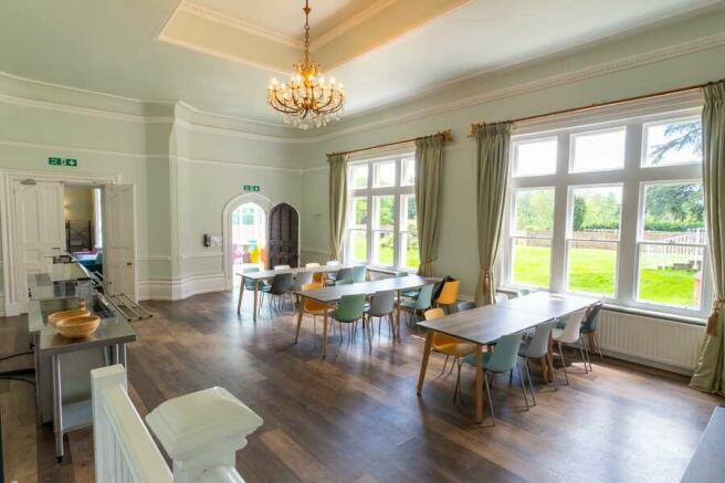
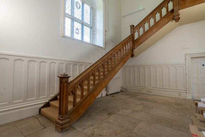
The former care home extends to 21,455 sq ft (1,993.17sq m) across three floors, including a purpose-built extension added in the early 2000’s and a basement floor. The main house has been partially refurbished into accommodation for youth rehabilitation.
The former stables, ‘The Coach House’ has been partially refurbished into office accommodation providing an additional 3,813 sq ft (354.23 sq m) of accommodation.
The site is ideally located in the village of Nether Wallop, located in the Test Valley approximately 4.7 miles northwest of the town of Stockbridge and 8 miles southwest of Andover. There are good road connections to the M3 via Winchester and the A303 to the north linking the West Country and via the A34 the Midlands.
Brochures
Former Youth Rehabilitation Centre in Hampshire For Sale, Grade II Listed property with modern extensions, set in c. 10.

NEAREST STATIONS
Distances are straight line measurements from the centre of the postcode- Grately Station3.4 miles
- Andover Station6.9 miles
About Savills, Margaret Street - Healthcare
33 Margaret Street, London, W1G 0JD
Notes
Disclaimer - Property reference 62C82F70-5BB7-43C7-9128-9511E28738E0. The information displayed about this property comprises a property advertisement. Rightmove.co.uk makes no warranty as to the accuracy or completeness of the advertisement or any linked or associated information, and Rightmove has no control over the content. This property advertisement does not constitute property particulars. The information is provided and maintained by Savills, Margaret Street - Healthcare. Please contact the selling agent or developer directly to obtain any information which may be available under the terms of The Energy Performance of Buildings (Certificates and Inspections) (England and Wales) Regulations 2007 or the Home Report if in relation to a residential property in Scotland.
Map data ©OpenStreetMap contributors.