Wolfhampcote, Rugby
- PROPERTY TYPE
Land
- SIZE
8,684,122 sq ft
806,782 sq m
Key features
- Pastureland situated to the west of Braunston
- Amenity potential
- Available as a whole or in 3 lots
- Extending to 199.36 acres (80.68 ha)
Description
Extending to 199.36 acres (80.68 ha).
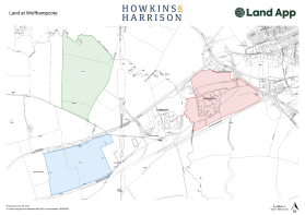
Lot 1: 64.89 acres
(edged red)
Lot 2: 58.99 acres
(edged blue)
Lot 3: 75.48 acres
(edged green)
Distances - •Daventry: 4 miles
•Rugby: 8 miles
•Leamington Spa: 15 miles
•Northampton: 18 miles
Situation - The land is situated to the west of the A45 at Braunston and lies within the parish of Wolfhampcote. The land straddles the Northamptonshire/Warwickshire County border, with Lots 2 & 3 falling within Warwickshire and Lot 1, Northamptonshire.
Access to the land is off the A45 to the east as well as from Nethercote/Flecknoe to the south. Further detail of the location can be found on the plan to the rear of the brochure.
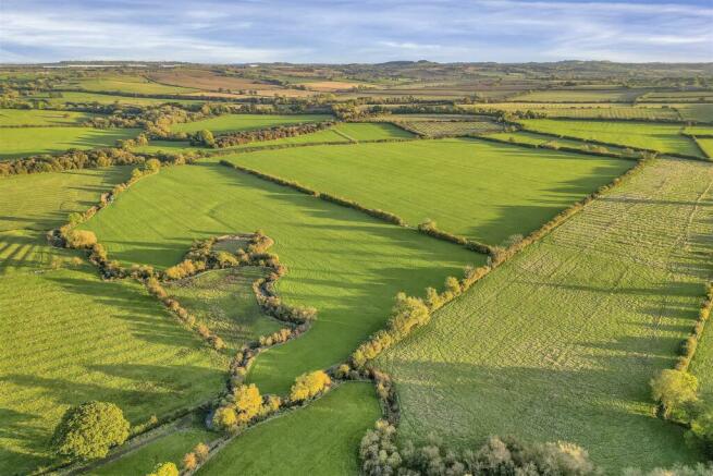
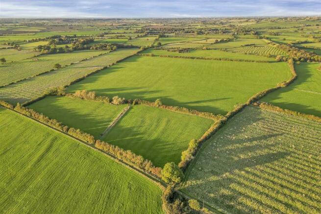
Description - The land on offer forms part of a wider holding, some of which is being retained. It is being offered as three individual lots or as a whole and offers purchasers the opportunity to acquire grazing land with the potential for other amenity or environmental uses.
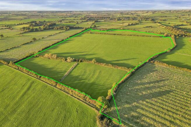
Lot 1 - Lot 1 (shown edged red) extends to 64.89 acres, comprising 63.93 acres of reasonably level ridge and furrow pastureland presented as two parcels with mature tree and hedgerow boundaries. The land benefits from direct access to the A45 (London Road).
The land would be suited to agricultural or equestrian use, although part is scheduled as an ancient monument with Historic England. (See designation paragraph).
Lot 2 - Lot 2 (shown edged blue) extends to 58.99 acres, comprising circa 58.86 acres of gently sloping pastureland and access track shown hatched orange on the site plan).
The land would be suited to agricultural or equestrian use.
The purchaser of Lot 2 will be responsible for the erection and maintenance thereafter of a stock proof boundary fence.
Lot 3 - Lot 3 (shown edged green) extends to 75.48 acres, comprising circa 75.41 acres of gently sloping ridge and furrow pastureland, presented as 3 parcels with mature tree and hedgerow boundaries.
The land would be suited to agricultural or equestrian use.
The purchaser of Lot 3 will be required to make a new point of entrance to the land at point Z on the attached plan. (Specification to be agreed).
Tenure And Possession - The property is offered for sale freehold with vacant possession of the land being given upon completion. All three Lots are registered under Title Number WK449111.
Land Grade And Soil Type - According to Natural England, the land is classified as a mix of Grade 3 and 4 on the Agricultural Classification Maps, being slowly permeable base-rich loamy and clay soil.
Basic Payment Scheme - The land is registered to receive payment under the Basic Payment Scheme and a claim was submitted for the 2023 scheme year by the occupier and this payment and the historic reference amounts will be retained by the vendor.
Countryside Stewardship Scheme - The land is not subject to any existing CSS agreements.
The agent is of the opinion that capital grant funding may be available through the scheme towards the necessary works required to make the land stock proof (such as fencing and water troughs).
Services - Water is via a shared supply from the eastern boundary of Lot 1.
The appropriate service connection rights will be reserved across Lot 1 for the benefit of the retained land and Lot 2, in the event of it being sold separately.
Lots 1 and 3 benefit from access to a natural water supply, with drinking points along the River Leam, which forms the western boundary of Lot 1 and the northern boundary of Lot 3.
Purchasers should note that it is their specific responsibility to investigate the availability of services. Easements for services will be granted (or retained) if required by the purchaser/vendor.
Access - Lot 1 can be accessed directly by the A45 (London Road) via a concrete bell mouth, which leads to a gated entrance at point A. From there, two gated concrete tracks provide access over the land to points B and C.
Access to Lot 2 is from Nethercote/Flecknoe to the south, via a gated entrance at Y on the site plan.
Access to Lot 3 is through Wolfhampcote and via a bridge over the Grand Union Canal. It will be the responsibility of the purchaser to make a new point of entrance to the land at point Z, via the area hatched green on the attached plan.
POINT OF NOTE: the canal bridge giving access to Lot 3 is subject to a 12t weight restriction.
Overage Clause - An overage clause will be included within the sales contract for Lots 1, 2 and 3 which will reserve 30% of any increase in value due to any non-agricultural or non-equestrian development that takes place on the land for a period of 30 years from the date of the sale, triggered upon implementation of planning, sale or long lease.
Designations - Within Lot 1 lies the former site of the deserted medieval village of Braunstonbury, which is a designated Scheduled Monument (List Entry Number: 1017580). Interested parties are advised that some ground operations may require Scheduled Monument Consent.
Rights Of Way - Lot 1 is subject to a general public right of access along the footpath and byway between points A and B on the site plan, which also benefits the residents of Wolfhampcote. Existing rights of access exist for private individuals over the land from point A to points C, D and E on the attached plan. Full details of which will be provided.
The appropriate rights of access will be granted for the purchasers of each lot as well as any that are required to be retained by the vendor.
The property is sold subject to and with the benefit of all existing rights, obligations, easements, and all wayleaves and covenants, whether disclosed or not.
Sporting, Timber And Mineral Rights - All rights are believed to be held with the freehold owner and will be included within a sale of the land.
Boundaries And Fencing - The external boundary responsibility is marked with a ‘T’ mark, where known.
Plan, Area And Description - These are based on the Ordnance Survey and Rural Land Register data and are there for reference only.
The plans, area and description are believed to be correct in every way, but no claim will be entertained by the vendor or the agents in respect of any error, omissions or misdescriptions.
Method Of Sale - The property will be offered for sale by private treaty as a whole or in three lots and interested parties should submit their offers to the agent’s Rugby office.
Lot 1: £400,000
Lot 2: £500,000
Lot 3: £470,000 (SSTC)
Whole: £1.37m
The vendor reserves the right to offer the property for sale in any order other than that described in these particulars, to sub-divide, amalgamate or withdraw the property from the sale without prior notice.
Vendor Solicitor - Alex Robinson, Wright Hassall, Olympus Ave, Leamington Spa, CV34 6BF
Tel.: 01926-883-009 | Email: alexandra.
Local Authorities - West Northamptonshire District Council Tel: 0300-1267-000
Rugby Borough Council Tel: 01788-533-533
Western Power Tel: 0800-6783-105
Severn Trent Water Tel: 03457-500-500
Viewing - Strictly by prior appointment through the agent’s Rugby office on 01788-564-680, or email .
Please be aware that livestock graze the land, therefore please keep gates closed and take appropriate biosecurity measures.
What3words - Lot 1: ///tweaked.steep.intruding
Lot 2: ///cascaded.length.agreement
Lot 3: ///reassured.bordering.develops
Anti Money Laundering Regulations - We are required under due diligence, as set up under HRMC, to take a full identification (e.g. photo ID and recent utility bill as proof of address) of a potential purchaser upon submitting an offer on a property.
Brochures
Wolfhampcote v3.pdfWolfhampcote, Rugby
NEAREST STATIONS
Distances are straight line measurements from the centre of the postcode- Long Buckby Station6.3 miles


At Howkins & Harrison, we are an independent firm of Chartered Surveyors, Auctioneers, Estate Agents, Valuers and Chartered Planners, with a reputation for providing a professional service.
We have been supporting homeowners, landowners and landlords since 1888 and we have 7 regional, high street offices and over 80 employees. We also have the benefit of an office on St James's Place in London, to promote our portfolio to commuters.
Covering a wide area of the Midlands, working across Warwickshire, Northamptonshire and Leicestershire, We offer total land, property & estate services for residential, commercial and agricultural clients.
If you're looking to buy, sell, let, rent, auction, extend, finance or develop, our experienced team are here to help.
Our Rugby office is located on Albert Street within the town centre. There is metered on street parking just outside the office. If you are able to pop in, we'd be delighted to see you.
Notes
Disclaimer - Property reference 32765270. The information displayed about this property comprises a property advertisement. Rightmove.co.uk makes no warranty as to the accuracy or completeness of the advertisement or any linked or associated information, and Rightmove has no control over the content. This property advertisement does not constitute property particulars. The information is provided and maintained by Howkins & Harrison LLP, Rugby. Please contact the selling agent or developer directly to obtain any information which may be available under the terms of The Energy Performance of Buildings (Certificates and Inspections) (England and Wales) Regulations 2007 or the Home Report if in relation to a residential property in Scotland.
Map data ©OpenStreetMap contributors.
