Lot 2 - 2.34 Ha (5.78 Acres) Land At Weston Lane, South Street, Normanton On Trent, Newark, Nottinghamshire, NG23 6RQ
£0.20 per sq ft
Business rates & charges may apply
- SIZE AVAILABLE
251,777 sq ft
23,391 sq m
- SECTOR
Farm land for sale
Key features
- For Sale by Informal Tender - 12 noon 5th December 2023
- For Sale individually or as part of a whole
Description
For Sale individually or as part of a whole
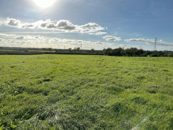
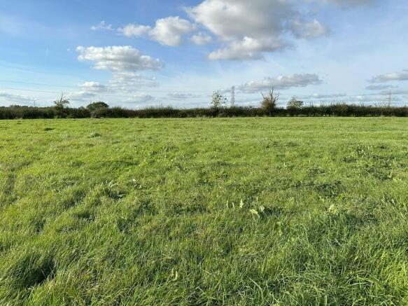
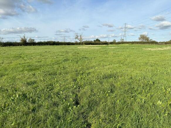
Lot 2 - 5.78 acres comprising a flat single grass field with access directly from Weston Lane via a field gate - for sale individually or as part of a whole
7.84 hectares (19.37 acres) of Grassland at Normanton-on-Trent, Newark
Detailed Description
The land is offered for sale as a whole or in individual lots by informal tender.
The land is down to permanent grassland and is classified as Grade 3 by the Provisional Agricultural Land Classification map. The soils are of the Whimple 3 series which are described as fine loamy or fine silty soils over clayey soils with slowly permeable subsoils.
LOT 2 - 2.34 HECTARES (5.78 ACRES)
Lot 2 is a flat, single grass field with access directly from Weston Lane via a field gate. It is bounded by mature hedges. The is a heap of Farm Yard Manure located in Lot 2, this can either be sold with the lot or removed if not required.
Location
The land is located to the south-west of the village of Normanton on Trent. The land is located to the south of Weston Lane. The land is easily accessible from nearby junctions off the A1 and villages to the west of the River Trent.
The land is accessed via the public adopted highway to the north known as Weston Lane. All lots benefit from gated access to the north. There is also gated access leading between the field parcels.
From the A1 junction at Tuxford, head south on the B1164 (Great North Road) towards the village of Weston. Take the first left onto Tuxford Road sign posted for Normanton on Trent/ Grassthorpe. Follow this road into the village of Normanton on Trent, turn right onto South Street. Continue on South Street for approximately 500m, at the left-hand bend turn right onto Weston Lane. The field entrances are located approximately 300 yards up the road.
Lot 2 - ///scribble.roosters.sculpting
Services
There are no services connected to the land. There are however private wells located in lot 1 and 2.
Viewing
The Property may be viewed at any time with a copy of these Particulars to hand subject to prior notification to the Seller's Agent.
Viewing is at your own risk and neither the Seller's Agent nor Seller take any responsibility for any losses or damages incurred during inspection. Please be aware of the risks associated with a working farm.
VAT
Should any sale of the land or any right attached to it become a chargeable supply for the purpose of VAT, such tax shall be payable by the Buyer in addition to the Contract Price.
Brochures
Lot 2 - 2.34 Ha (5.78 Acres) Land At Weston Lane, South Street, Normanton On Trent, Newark, Nottinghamshire, NG23 6RQ

NEAREST STATIONS
Distances are straight line measurements from the centre of the postcode- Collingham Station5.4 miles
- Swinderby Station5.7 miles
Notes
Disclaimer - Property reference 439262FH. The information displayed about this property comprises a property advertisement. Rightmove.co.uk makes no warranty as to the accuracy or completeness of the advertisement or any linked or associated information, and Rightmove has no control over the content. This property advertisement does not constitute property particulars. The information is provided and maintained by Brown & Co, Lincoln. Please contact the selling agent or developer directly to obtain any information which may be available under the terms of The Energy Performance of Buildings (Certificates and Inspections) (England and Wales) Regulations 2007 or the Home Report if in relation to a residential property in Scotland.
Map data ©OpenStreetMap contributors.