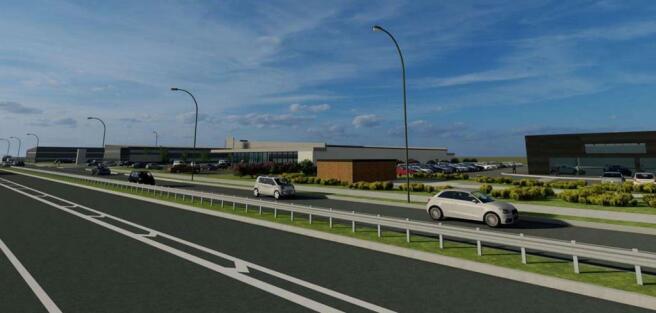
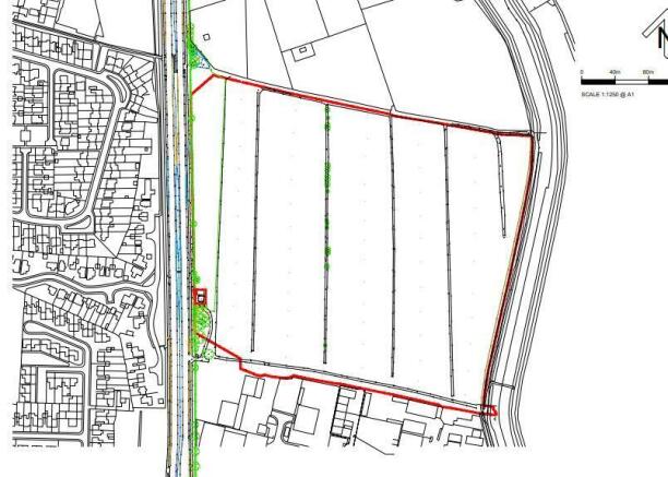
The Point, Land North of Formby Industrial Estate, Formby, Merseyside
- SIZE AVAILABLE
9,200-100,000 sq ft
855-9,290 sq m
- SECTOR
Light industrial facility for sale
Key features
- Proposed development of employment units (B2, B8 and E), subject to planning.
- Serviced plot sales available - subject to design brief.
- Modern portal frame warehouse/employment / office / leisure / retail units proposed from 920 square metres (9,900 square feet) GIA approx. and upwards.
- Turnkey leasehold or freehold design and build packages available.
- Strategic employment location north of Formby Industrial Estate.
- Development to provide up to 27,000 square metres (290,065 square feet) GIA approx. of employment floor space.
- Estimated timing approximately 18-24 months from the grant of planning.
Description
It is proposed the highest quality of accommodation will be delivered throughout the site, in an attractive landscaped setting. It is anticipated that subject to planning, serviced plot sales, or leasehold or freehold design and build packages could be available 18-24 months from the grant of planning.
Brochures
The Point, Land North of Formby Industrial Estate, Formby, Merseyside
NEAREST STATIONS
Distances are straight line measurements from the centre of the postcode- Formby Station1.2 miles
- Freshfield Station1.5 miles
- Hightown Station2.2 miles
Notes
Disclaimer - Property reference 2203FH. The information displayed about this property comprises a property advertisement. Rightmove.co.uk makes no warranty as to the accuracy or completeness of the advertisement or any linked or associated information, and Rightmove has no control over the content. This property advertisement does not constitute property particulars. The information is provided and maintained by Fitton Estates, Merseyside/Lancashire. Please contact the selling agent or developer directly to obtain any information which may be available under the terms of The Energy Performance of Buildings (Certificates and Inspections) (England and Wales) Regulations 2007 or the Home Report if in relation to a residential property in Scotland.
Map data ©OpenStreetMap contributors.


