Buxton Road, High Peak, Derbyshire, SK23

- SIZE AVAILABLE
55,757-541,886 sq ft
5,180-50,343 sq m
- SECTOR
Land for sale
- USE CLASSUse class orders: Sui Generis
sui_generis_3
Key features
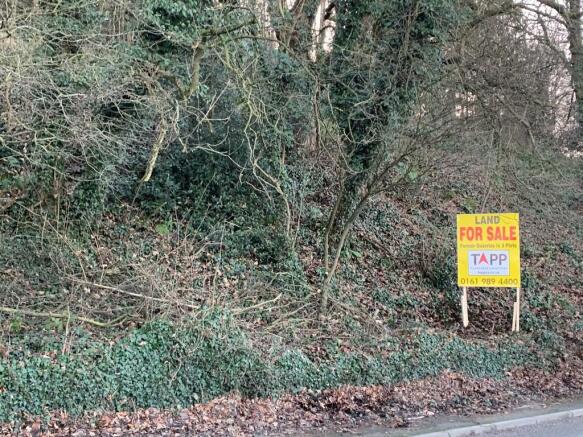
- A PARCEL OF HEATH LAND
- FRONTAGE TO A6 BUXTON ROAD
- MANCHESTER CITY CENTRE - 15 MILES
- STOCKPORT - 8 MILES
- WHALEY BRIDGE - 3 MILES
Description
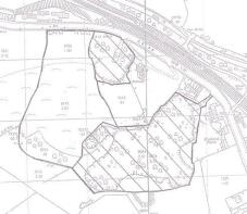
available for sale as a whole. It measures approximately 5.56 acres (2.25 ha).
Available for sale as a whole. Please contact the office to discuss your proposals.
Brochures
Buxton Road, High Peak, Derbyshire, SK23

NEAREST STATIONS
Distances are straight line measurements from the centre of the postcode- Furness Vale Station0.7 miles
- New Mills Newtown Station0.1 miles
- New Mills Central Station0.6 miles
About Tapp Chartered Surveyors, Leeds
4 Park Place, Leeds, LS1 2RU
Notes
Disclaimer - Property reference FVL1. The information displayed about this property comprises a property advertisement. Rightmove.co.uk makes no warranty as to the accuracy or completeness of the advertisement or any linked or associated information, and Rightmove has no control over the content. This property advertisement does not constitute property particulars. The information is provided and maintained by Tapp Chartered Surveyors, Leeds. Please contact the selling agent or developer directly to obtain any information which may be available under the terms of The Energy Performance of Buildings (Certificates and Inspections) (England and Wales) Regulations 2007 or the Home Report if in relation to a residential property in Scotland.
Map data ©OpenStreetMap contributors.