
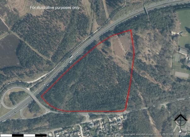
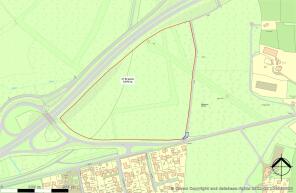
Longmoor Road, Liphook

- PROPERTY TYPE
Land
- SIZE
954,835 sq ft
88,707 sq m
Key features
- Woodland for sale
- 22 acres
- Suitable for a variety of leisure pursuits
- Outside Settlement Area
Description
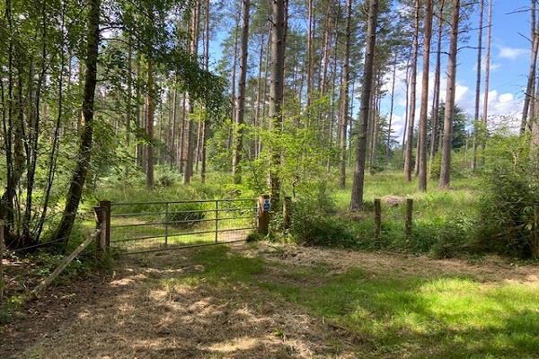
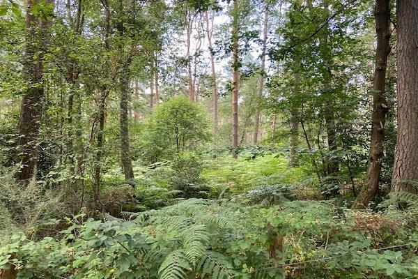
A private parcel of predominantly pine and spruce trees with a few clearings close to the South Downs National Park, suitable for a variety of recreational pursuits. There are no public rights of way across the land, although a bridleway runs parallel. There are some power cables crossing the land.
There is no woodland management plan in place and the land is not being sold with any conditions. There are no planning permissions or applications currently on the land which lies outside any Settlement Policy Area for East Hampshire.
No services are connected, although we understand that all public utilities are close by or in the public highway. No service checks were carried out.
Viewings
Interested parties can visit the land unaccompanied but sturdy boots are advised as the land is overgrown and access is not easy across the whole of the land.
Tenure - Freehold
Brochures
Longmoor Road, LiphookLongmoor Road, Liphook

NEAREST STATIONS
Distances are straight line measurements from the centre of the postcode- Liphook Station1.2 miles
- Liss Station3.9 miles
- Haslemere Station4.6 miles


Notes
Disclaimer - Property reference 31689802. The information displayed about this property comprises a property advertisement. Rightmove.co.uk makes no warranty as to the accuracy or completeness of the advertisement or any linked or associated information, and Rightmove has no control over the content. This property advertisement does not constitute property particulars. The information is provided and maintained by Clarke Gammon, Haslemere. Please contact the selling agent or developer directly to obtain any information which may be available under the terms of The Energy Performance of Buildings (Certificates and Inspections) (England and Wales) Regulations 2007 or the Home Report if in relation to a residential property in Scotland.
Map data ©OpenStreetMap contributors.